

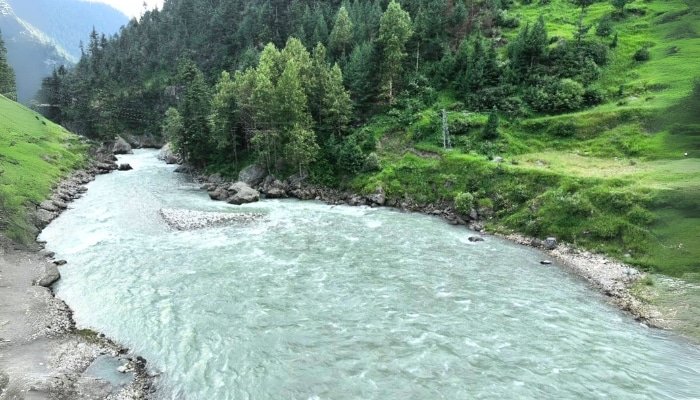
Murree to Naran Kaghan: Distance, Route & Complete Travel Guide (2026)
- ✔Distance (Route A — via Abbottabad): ~260–270 km | 5–6 hours driving
- ✔Distance (Route B — via Muzaffarabad/AJK): ~197 km | 6–7 hours (scenic, slower road)
- ✔With stops (fuel, meals, photos): add 1–2 hours to either route
- ✔Best start time: Pre-dawn (4–5 AM) from Murree for a daylight arrival in Naran
- ✔Season: June–September (all passes open); avoid November–April
- ✔Vehicle: Regular car fine for both routes; hire local jeeps for Saif-ul-Mulook/Siri Paye after arriving
- ✔Fuel: Last reliable station in Balakot (Route A) or Mansehra — fill up before proceeding
- ✔Cash: No ATMs in Naran town — withdraw in Abbottabad or Mansehra
- ✔MNJ Road & Babusar Top (June 2026): Both open — Babusar opened 27 May 2026
Murree to Naran Kaghan: Why This Road Trip Belongs on Your List
Two of northern Pakistan’s most beloved destinations sit within a single day’s drive of each other. Murree — the pine-clad hill station dubbed the Queen of the Hills — and Naran Kaghan — a high alpine valley of glacial lakes, snow-capped passes, and the roaring Kunhar River — are connected by roads that are themselves part of the experience.
This guide gives you everything you need: the corrected and verified distance, two complete route options with stop-by-stop breakdowns, current 2026 road status, a distance comparison from all major Pakistani cities, a packing list, and a month-by-month travel calendar.
Murree to Naran Kaghan Distance — Verified 2026
There are two viable road routes between Murree and Naran, and they produce different distances. This matters because the choice of route also determines your experience on the way.
| Route | Via | Distance | Drive Time | Road Quality | Best For |
|---|---|---|---|---|---|
| Route A (Standard) | Abbottabad → Mansehra → Balakot → N-15 | ~260–270 km | 5–6 hrs (+ stops) | Hazara Expressway + paved N-15; excellent | Most travelers, fastest, most services |
| Route B (Scenic/AJK) | Muzaffarabad → Garhi Habibullah → Balakot | ~197 km | 6–7 hrs (+ stops) | Narrower AJK roads; scenic but slower | Those wanting AJK scenery, road-trippers |
Bottom line: The standard route (Route A via Abbottabad) covers approximately 260–270 km and takes 5–6 hours of driving, making it the fastest connection. The scenic AJK route (Route B via Muzaffarabad) covers approximately 197 km but takes 6–7 hours due to slower mountain roads in Azad Kashmir. Neither route is 310 km — that earlier figure was incorrect.
Travel time with stops: Allow 7–9 hours total for a comfortable journey on Route A, including fuel, a meal, and a photo stop or two. Route B, with its additional viewpoints, warrants a full day.
Route A (Recommended): Murree → Abbottabad → Naran
This is the most-traveled route between Murree and Naran Kaghan, used by the overwhelming majority of Pakistani and international visitors. It combines well-surfaced roads, reliable fuel and food stops, and a gradual transition from the Hazara plains to the alpine valley.
Full route: Murree → Murree Road descent → Havelian → Abbottabad → Mansehra → N-15 → Balakot → Kaghan → Naran
Stop-by-Stop Breakdown — Route A
| Stop | Notes | Distance / Time | Practical Tips |
|---|---|---|---|
| Murree | Start point — fill tank, buy breakfast to go | 0 km / 0 hrs | Depart 4–5 AM for best timing |
| Murree → Abbottabad descent | Winding downhill road via Havelian; beautiful pine scenery | ~80 km / 1.5–2 hrs | Take it slow — sharp turns. Brake check before descent. |
| Abbottabad | City bypass. Last major ATM, pharmacy, supermarket. | ~80 km / 2 hrs | Withdraw cash here. Last pharmacy before Naran. |
| Abbottabad → Mansehra | Short and fast on a dual carriageway | ~17 km / 20–25 min | Merge onto N-15 toward Balakot after Mansehra. |
| Mansehra | Fuel, lunch, and the last large supermarket | ~97 km / 2.5 hrs | Fill fuel tank here — critical. Last large food stop. |
| Mansehra → Balakot | N-15 enters the Kaghan Valley foothills | ~35 km / 40 min | Road narrows. The first mountain section begins. |
| Balakot | Last fuel station before Naran. River views begin. | ~132 km / 3.5 hrs | Top up fuel. Stock snacks and water. |
| Balakot → Kaghan Town | Kunhar River runs alongside. Pine forests. | ~45 km / 1 hr | First true mountain road — no overtaking. |
| Kaghan Town | Tea stop. Good roadside views. | ~177 km / 4.5 hrs | Quick stop only — 23 km more to Naran. |
| Kewai Waterfall | Roadside glacier-fed waterfall — 5 min walk | ~200 km / 5 hrs | Easy stop. Kids love it. |
| Naran / Walnut Riverside Resort | Arrive before sunset | ~260–270 km / 5–6 hrs | Check in. Pre-book a jeep for Day 2. |
Route A — Segment Time Summary
- Murree to Abbottabad: ~80 km | 1.5–2 hours
- Abbottabad to Mansehra: ~17 km | 20–25 minutes
- Mansehra to Balakot: ~35 km | 40 minutes
- Balakot to Kaghan Town: ~45 km | 1 hour
- Kaghan Town to Naran: ~23 km | 45 minutes
- Total: ~260–270 km | 5–6 hours driving | 7–9 hours with stops
Route B (Scenic): Murree → Muzaffarabad → Naran
This route passes through Azad Jammu & Kashmir before entering Kaghan Valley from the south via Garhi Habibullah and Balakot. At approximately 197 km by road, it is shorter than Route A, but the AJK mountain roads are narrower and slower, so it typically takes as long as or longer than Route A. The payoff is a dramatically different landscape and the option to explore Muzaffarabad, the Kunhar River from a different angle, or Neelum Valley as a side trip.
Full route: Murree → Kohala Bridge → Muzaffarabad → Garhi Habibullah → Balakot → N-15 → Kaghan → Naran
Stop-by-Stop Breakdown — Route B
| Stop | Notes | Distance / Time | Tips |
|---|---|---|---|
| Murree | Start — fill tank before descent | 0 km / 0 hrs | Depart early — AJK roads are slower |
| Kohala Bridge | Cross into AJK. Jhelum River below — dramatic. | ~30 km / 45 min | Good photo stop. |
| Muzaffarabad | AJK capital. Fuel, food, and an optional city stop. | ~65 km / 1.5 hrs | Combine with the Neelum Valley detour if you have an extra day. |
| Garhi Habibullah | Small town. Tea stop on the Kunhar River. | ~110 km / 2.5 hrs | The road to Kaghan Valley joins from the AJK side here. |
| Balakot | Joins Route A. Last fuel station. | ~155 km / 3.5 hrs | Fill up fully from here. |
| Kaghan → Kewai → Naran | Standard N-15 valley road | ~197 km / 6–7 hrs | Same final stretch as Route A. |
Who should take Route B?
- Travelers who want to explore Muzaffarabad or Neelum Valley on the way.
- Road-trippers who prioritize scenery over speed.
- Those staying in Murree and wanting the shorter-distance option, with a relaxed pace.
- Photographers: the Jhelum River gorge at Kohala Bridge and the Kunhar approach from Garhi Habibullah are outstanding.
Note: Route B roads are narrower in sections between Kohala and Muzaffarabad. Heavy monsoon rain (July–August) can cause delays or brief closures at river crossings in AJK. Check conditions if traveling in the monsoon season.
Murree to Naran Kaghan vs. Other Cities — Distance Reference
Planning from another city? Use this table to set expectations:
| Starting City | Distance to Naran | Drive Time | Route Summary |
|---|---|---|---|
| Murree (via Abbottabad) | ~260–270 km | 5–6 hrs | Murree → Abbottabad → Mansehra → Balakot → N-15 → Naran |
| Murree (via Muzaffarabad) | ~197 km | 6–7 hrs | Murree → Kohala → Muzaffarabad → Garhi Habibullah → Balakot → Naran |
| Islamabad / Rawalpindi | ~280–285 km | 6–7 hrs | Hazara Expressway → Abbottabad → Mansehra → Balakot → N-15 → Naran |
| Lahore | ~640–680 km | 12–14 hrs | M-2 motorway → Islamabad → Hazara Expressway → Abbottabad → N-15 → Naran |
| Abbottabad | ~142 km | 3.5–4 hrs | Abbottabad → Mansehra → Balakot → N-15 → Naran |
| Mansehra | ~119 km | 3–3.5 hrs | Mansehra → Balakot → N-15 → Naran |
| Balakot | ~85 km | 2–2.5 hrs | N-15 straight up the valley |
| Peshawar | ~345 km | 6–7 hrs | Peshawar → M-1 → Islamabad → Hazara Expressway → Abbottabad → N-15 → Naran |
2026 Road Conditions & Updates
MNJ Road — Open June 2026
The Mansehra–Naran–Jalkhad (MNJ) Road, the main artery into the Kaghan Valley, was closed in November 2025 for winter. NHA clearance operations ran through April–May 2026, cutting through glacial snowpack and opening the road to Naran for the 2026 season. As of June 2026, the road is open, and the valley is fully accessible.
The full KP-to-Gilgit-Baltistan link (onward to Chilas via Babusar) opened on 27 May 2026.
Babusar Top — Open Since 27 May 2026
Babusar Top (4,173 m) opened on 27 May 2026 for the 2026 season. Travel is permitted daylight-only: 7:00 AM to 6:00 PM. Some residual snow remains on the roadside in June — caution advised. Diamer Police checkposts are active at the summit. Verify status on your travel day, as brief weather closures can occur even in-season.
NHA N-15 Road-Widening Project
NHA has initiated feasibility and detailed design work for upgrading the 235 km Mansehra–Naran–Jalkhad–Chilas highway into a four-lane divided expressway. In the short term, expect construction-related delays in the Kawai–Paras section. Some weekday closures for construction work have been reported — build in a time buffer on weekday travel.
Monsoon Season (July–August)
Monsoon rains bring frequent landslides on the N-15 between Paras and Naran. A drive that normally takes 2–3 hours from Balakot can extend to 5–6 hours after heavy rain. Always carry a rain shell, start mountain drives before 8 AM, and check local road conditions via the Kaghan Hoteliers Association or local social media groups before departing.
Best Time to Travel from Murree to Naran Kaghan
| Month | Rating | Conditions | Watch Out For |
|---|---|---|---|
| May | ⭐⭐⭐ | MNJ Road is open. Shogran accessible. Snow on high passes early in the month. | Babusar Top opened on 27 May 2026. Check before planning. |
| June | ⭐⭐⭐⭐⭐ | All routes open. Long days. Saif-ul-Mulook at its clearest. | Book 2–4 weeks ahead. Crowds build after 10 June. |
| July | ⭐⭐⭐⭐ | Lush green valley. Monsoon rains possible. | Carry rain gear. Check the road after heavy rain. |
| August | ⭐⭐⭐⭐ | Peak season. Independence Day very crowded. | Avoid the Eid/14 Aug weekend if crowds concern you. |
| September | ⭐⭐⭐⭐⭐ | Clear skies, thin crowds, best photography. | Best overall month. Book early as word spreads. |
| October | ⭐⭐⭐ | Autumn colours. Pass closures begin late in the month. | Verify Babusar’s status. Some hotels close mid-Oct. |
| Nov–Apr | ❌ | MNJ Road is closed. Naran inaccessible. | Not recommended for general travel. |
June and September are the optimal months to travel from Murree to Naran. June delivers open passes and lush valley after the spring snowmelt. September offers the clearest skies and thinnest crowds of the summer season.
What to See & Where to Stop Along the Way
On Route A (via Abbottabad)
Ayubia National Park (near Murree — 20 km)
Just 20 km from Murree, Ayubia National Park sits in dense pine and oak forest in the Galliyat range. A chairlift connects Ayubia to Dungagali. This is an optional detour (1.5–2 hours) that works well if you depart Murree at 4 AM — you can pause at Ayubia at sunrise before continuing.
Thandiani (near Abbottabad — 35 km off-route)
A high meadow above Abbottabad at 2,750 m with panoramic Himalayan views. Worth the detour on a clear day. From Thandiani, you can see Nanga Parbat on a clear winter day, though summer haze often limits visibility.
Balakot Town
Balakot sits at the mouth of Kaghan Valley. The Kunhar River flows through town. Rebuilt after the 2005 earthquake, Balakot has a busy market, riverside tea spots, and is the last opportunity for a proper restaurant meal before Naran. Plan 30–45 minutes here.
Kewai Waterfall
A glacier-fed waterfall right on the N-15 highway, between Balakot and Kaghan Town. Pull over and walk to the falls in under 5 minutes. A small cafe is nearby. One of the easiest and most enjoyable stops on the entire route — especially welcome after hours of mountain driving.
Shogran Turnoff (optional detour)
About 20 km before Naran, a road branches off to Shogran (accessible via Kiwai). If you want to visit Shogran and Siri Paye Meadows, this is where you turn off. Budget an extra full day for this detour — it is not a quick stop.
On Route B (via Muzaffarabad)
Kohala Bridge
The point where Murree descends to meet the Jhelum River and cross into Azad Kashmir. The bridge spans a deep gorge — a dramatic and photogenic crossing worth a brief stop.
Muzaffarabad
The capital of AJK is situated at the confluence of the Jhelum and Neelum rivers. The Red Fort (Muzaffarabad Fort) overlooks the city from a ridge. A 1–2-hour stop allows for a riverside walk and lunch. If you have flexibility, Muzaffarabad serves as the gateway to Neelum Valley — a separate trip entirely.
Garhi Habibullah
A small town on the Kunhar River where the AJK route rejoins the standard N-15 corridor. The Kunhar here runs fast and wide — excellent for river photography. From Garhi Habibullah, you are on the same road as Route A travelers heading north to Balakot and Naran.
Where to Stay in Naran Kaghan
Walnut Riverside Resort sits directly on MNJ Road along the Kunhar River in Kaghan Valley — 5 minutes from Naran Bazaar and the main jeep stand for Saif-ul-Mulook, Babusar Top, and Siri Paye. After a 6–9-hour drive from Murree, having your accommodation right on the river, with an on-site cafe (Cafe de Zar), makes the arrival infinitely more comfortable.
Room options: Suites, Exclusive Rooms, Chalets & Villas, Huts & Cottages — for families, couples, and groups.
Contact: +92 343 000 6002 | info@walnutriversideresort.com | walnutriversideresort.com
Recommended Day Plan: Murree to Naran (Route A)
- 4:00–4:30 AM — Depart Murree. Fill the tank the night before. Carry breakfast.
- 5:30–6:30 AM — Abbottabad. Withdraw cash. Quick fuel check if needed.
- 7:00–7:30 AM — Mansehra. Full tank. Proper breakfast at a dhaba.
- 8:00–8:30 AM — Balakot. Top up fuel. Buy snacks and water.
- 8:30–9:30 AM — Kewai Waterfall. 10-minute stop. Fresh air and cool mist.
- 10:00–10:30 AM — Kaghan Town. Quick chai.
- 11:00–11:30 AM — Arrive at Naran / Walnut Riverside Resort. Check in.
- Afternoon — Pre-book a jeep for Saif-ul-Mulook the next morning. Evening river walk.
This plan puts you in Naran by mid-morning with the full afternoon free time enough to explore Naran Bazaar, walk the Kunhar riverside, and arrange the next day’s activities without feeling rushed.
Packing Checklist: Murree to Naran Kaghan
| Category | What to Bring | Notes |
|---|---|---|
| Documents | CNIC (mandatory at checkpoints), driving license, vehicle registration | Foreigners: passport + NOC from police |
| Navigation | Download offline Google Maps before Balakot | Signal weak/absent after Paras and on all trekking routes |
| Cash | PKR 10,000–20,000 in cash | No ATM in Naran — last in Abbottabad/Mansehra |
| Fuel | Full tank from Balakot | No stations above Naran Bazaar |
| Clothing | Fleece/puffer + waterproof rain shell | Naran nights drop to 8–12°C even in July |
| Footwear | Sturdy walking shoes or light trekking boots | Jeep tracks and nature walks are uneven |
| Health | Altitude tablets (Diamox), first aid, sunscreen SPF 50+ | UV is intense at 2,400 m+. Consult a doctor for Diamox. |
| Power | Power bank 10,000 mAh+, car charger | Load-shedding common in the upper valley |
| Connectivity | Telenor or Zong SIM | Best signal in Naran. Jazz/Ufone weak above Balakot. |
| Food/Water | Reusable bottle, dry fruit, snacks | Restaurants thin above Kaghan Town |
Vehicle & Driving Tips
Do I need a 4×4?
No — for the drive from Murree to Naran on either Route A or Route B, a regular sedan or hatchback is perfectly adequate. The Hazara Expressway, N-15, and AJK roads are all paved. The mountain sections after Balakot are narrow but sealed.
However, once you arrive in Naran, your own vehicle is not suitable for the day trips. The jeep tracks to Saif-ul-Mulook (9 km unpaved switchbacks), Siri Paye, Lulusar Lake, and Babusar Top require local 4×4 jeeps. Park your car at the hotel and hire jeeps from Naran Bazaar for all excursions.
Key driving rules on mountain roads
- No night driving: Mountain roads above Balakot have no street lighting and sharp blind turns. Arrive before dark or wait until morning.
- Sound horn at blind corners: Standard mountain driving practice on narrow N-15 sections.
- No overtaking in narrow sections: Particularly between Kaghan and Naran.
- Descents: Use engine braking on Murree descent. Don’t ride the brakes continuously.
- Keep to the mountainside: On narrow roads, hug the uphill side.
Frequently Asked Questions
A. The correct distance is approximately 260–270 km via the standard route (Murree → Abbottabad → Mansehra → Balakot → N-15 → Naran). Via the AJK/Muzaffarabad route, the distance is approximately 197 km. An earlier version of this article stated 310 km — that figure was incorrect and has been corrected.
A. On Route A (via Abbottabad), plan 5–6 hours of pure driving time. Add 1.5–2 hours for fuel stops, a meal in Mansehra, and a photo stop, bringing the total journey to 7–9 hours. A pre-dawn departure (4–5 AM) from Murree puts you in Naran by mid-morning.
A. Route A is faster and has more services — recommended for most travelers, families, and first-timers. Route B (via Muzaffarabad) is approximately 65 km shorter but takes 1–2 hours longer due to narrower AJK roads; it is ideal if you want to explore Muzaffarabad, Kohala Bridge, or the Neelum Valley on the same trip.
A. Yes. Both Route A and Route B are paved throughout and suitable for standard sedans, hatchbacks, and SUVs. You do not need a 4×4 for the main road. Hire local 4×4 jeeps in Naran Bazaar for all-day trips (Saif-ul-Mulook, Siri Paye, Babusar Top) — your own vehicle should stay parked at the hotel.
A. Yes. The MNJ Road opened for the 2026 season in May 2026. Babusar Top (beyond Naran) also opened on 27 May 2026. Both roads are open as of June 2026. The road typically stays open until November, when winter snowfall closes it again.
A. June and September are the best months. June brings open passes and the valley at its freshest after snowmelt. September offers the clearest weather, thinnest crowds, and best photography conditions. July and August are peak season — lush and dramatic but crowded on long weekends.
A. Yes — Abbottabad, Mansehra, and Balakot all have fuel stations. However, there are no fuel stations above Balakot on the N-15 (after Naran Bazaar). Fill up completely in Balakot — or at least Mansehra — before continuing into the valley.
A. Abbottabad and Mansehra both have multiple ATMs. Withdraw cash before entering the valley; jeep drivers, local shops, and trail guides are all cash-only. One ATM in Naran Bazaar (BankIslami), but unreliable, withdraw before entering the valley
A. No. Avoid all mountain sections (particularly Balakot to Naran) after dark. Roads are narrow and unlit, with sharp blind bends. The descent from Murree to Abbottabad should also be done in daylight. A pre-dawn start (4–5 AM) from Murree keeps all mountain sections in daylight hours.
A. Telenor and Zong offer the most consistent coverage along the N-15 and in Naran town. Signal becomes unreliable above the bazaar and disappears on most trekking routes. Download offline Google Maps before leaving Mansehra.
A. Easily — this is in fact one of Pakistan’s classic northern combination itineraries. Spend 1–2 nights in Murree, then drive to Naran for 3–4 nights. You could also reverse the order: Naran first for the high-altitude adventure, then descend to Murree for a gentler finale before returning to Lahore or Islamabad
Related Guides on walnutriversideresort.com
- Lahore to Naran Kaghan: Distance, Route & Complete Travel Guide (2026)
- Best Places to Visit in Naran Kaghan — The Complete 2026 Guide
- Kaghan Weather Guide: Best Time & Monthly Tips
- Best Hotels in Naran Kaghan (2026 Comparison)
- How to Reach Walnut Riverside Resort, Kaghan
Disclaimer: This article is for general information only. We work to keep details accurate, up to date, and well-referenced, but we cannot promise completeness or perfect accuracy. All images, videos, and logos are the property of their respective owners. We try to credit sources appropriately. If you are the rights holder and want your asset removed, please contact us.
Author

Where to stay in Kaghan Valley
Make Walnut Riverside Resort your base in Naran & Kaghan
Riverfront rooms & suites on the Kunhar River, heated in winter, with Cafe de Zar dining on site. Book direct and skip the third-party commission.